
Nobody on board knew what lay beneath them
A quiet yacht passage can look completely ordinary from deck level. Then one small wreck symbol on the chart changes the water beneath the hull into a historical landscape.

From the deck, the first impression is usually simple: pale water, a low Cornish horizon, the steady rhythm of the hull and a coastline that seems to explain itself. A yacht turns, settles into its course and the sea appears almost empty. There is nothing in the view that announces iron, timber, boilers, anchors or the outline of a vessel lying beneath the surface.
That contrast is what makes a wreck-site journey so compelling. The sea keeps its history out of sight. A location can pass beneath a keel in seconds while the event that made it significant belongs to another century.
“Nobody knew what was hidden beneath their yacht — because there was nothing on the surface to suggest that a documented wreck-site was there at all.
A normal passage, until the chart says otherwise
On an ordinary coastal route, attention naturally stays above the waterline: weather, headlands, nearby craft and the changing shape of the shore. The historical layer appears only when a chart mark, a name or a record is introduced. At that moment the journey acquires a second geography — one made not just of bays and reefs, but of events.

The moment of recognition
“Nobody on board knew what lay beneath them” is not a claim
about a hidden treasure or a new discovery. It is the much quieter surprise of realising that a recorded
historical site can sit beneath an apparently ordinary stretch of sea.
The name beneath the water: SS Mohegan
One documented example on the Cornish coast is SS Mohegan. Historic England Research Records describe the remains of the English liner off the Lizard peninsula, where the vessel foundered after grounding on the Manacles Reef on 14 October 1898. The record identifies her as a steel-built steamer, built in Hull in 1898, launched as Cleopatra and renamed Mohegan in the same month she was lost.
The ship was bound from Tilbury for New York. Historic England records 197 people aboard and states that 106 are thought to have drowned. The wreck became part of the maritime history of St Keverne, where a memorial records the loss.
Recorded wreck
SS Mohegan
A steel-built passenger liner recorded by Historic England as wrecked on the Manacles Reef off the Lizard peninsula, Cornwall.
- Date of loss
- 14 October 1898
- Route
- Tilbury to New York
- Construction
- Steel-built steamer
- Record
- Historic England Research Records
What the historical record actually tells us
The surviving record is powerful precisely because it does not need embellishment. The Mohegan was new. She was on a transatlantic passage. She grounded on the Manacles and went down rapidly. Contemporary and later records preserve the location, the vessel’s identity and the human cost of the loss.
There are variations between historical sources in some passenger and loss figures. For this article, the principal wreck details follow the Historic England Research Records entry, while the memorial in St Keverne separately commemorates 106 people who perished. That is enough to understand why the site belongs to the historical landscape of this coast.
“Nobody on this yacht expected what was hidden below — not because the wreck was unknown, but because recorded history can be visually absent from the sea above it.
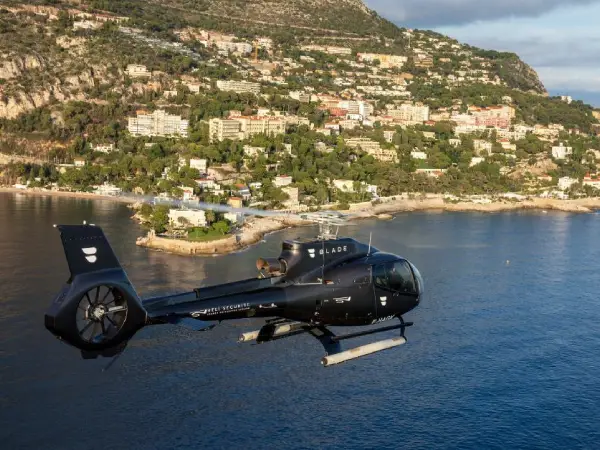
The wreck did not disappear from the story
The remains are still recorded off the Lizard. Falmouth’s official visitor information also identifies the Mohegan as a wreck that can be found today and notes its continuing interest to divers. Above the site, however, the experience is fundamentally different: the surface remains open water.
That is the central paradox of wreck-site travel. A location can be historically dense and visually minimal at the same time. The coastline may provide the frame, but the meaning comes from knowing what happened there.
Historic facts in this feature are based on Historic England Research Records, the Royal Museums Greenwich maritime memorial record and Falmouth’s official wreck information. The article does not claim a new discovery or newly identified wreck.

One reef, several layers of maritime history
The Mohegan is not the only recorded wreck associated with this part of Cornwall. Historic England’s records also document HMS Primrose, a Royal Navy brig-sloop lost on the Manacles in 1809, and Volnay, a Scottish cargo vessel lost in 1917 after being mined and later sinking in Porthallow Bay.
Placed side by side, these records show why a wreck-site route can function as a moving historical timeline. The sites belong to different periods, different vessel types and different circumstances, yet they occupy the same broad coastal landscape.
HMS Primrose
Historic England records the wreck of the British sloop of war after grounding on the Manacles while bound for Corunna.
SS Mohegan
The steel-built liner foundered after grounding on the Manacles during a passage from Tilbury to New York.
Volnay
Historic England records the Scottish cargo vessel as mined before sinking in Porthallow Bay.
When a story becomes a route
After the wreck record is introduced, the idea of the voyage changes. A headland is no longer only a headland; a reef is no longer only a navigational feature. The route becomes a way of reading maritime history from the water, moving between present-day scenery and documented events beneath or beside it.
This is where the editorial story naturally meets the excursion itself. Rather than presenting the coast as a catalogue of attractions, a marine-history route uses the sequence of places to explain how ships, navigation and the shoreline intersected over time.
Continue to the marine-history excursionsFrom article to water
Marine excursions through documented wreck locations
Below the Wake uses the same editorial idea as the basis for marine excursion enquiries: begin with the coast as it looks today, then introduce the historical wreck records that change how the route is understood.
The emphasis remains on place, context and maritime history. Enquiries are used to discuss the available route and practical details before any arrangement is confirmed.
Ask about an excursion
The point is not to make the sea more dramatic
The sea already holds enough history. The strongest wreck-site journeys do not need invented treasure, unnamed victims, exaggerated discoveries or claims that a site has just been found. What matters is the shift in perspective: the same water looks different once a reliable record is attached to it.
That is why the phrase “nobody on board knew what lay beneath them” works best as a beginning, not a conclusion. The real story starts after the surprise, when the wreck gains a name, a date and a place in the wider history of the coast.
Reader questions
FAQ
Are the wrecks in the article real documented sites?
Yes. The principal wreck in the story, SS Mohegan, and the additional examples HMS Primrose and Volnay are recorded in Historic England Research Records.
Does the article claim a new discovery?
No. The editorial premise is the surprise of passing above or near a known historical location without seeing it from the surface. It does not present any wreck as newly discovered.
What is a marine-history excursion enquiry?
It is a request to discuss an excursion concept built around documented maritime locations and the stories connected with them. Practical route details are discussed in response to the enquiry.
How do I ask about an excursion?
Use the enquiry form below with your contact details and a short note about what you would like to know. The information is used to respond to that request.
Route enquiry
Start with the story you want to follow
Tell us what you would like to know about marine excursions connected with historic wreck locations.
Editorial note
Historical wreck information is presented from the cited public heritage records and is intended to provide context for the maritime locations discussed. Wreck sites, coastlines and marine routes should be approached with appropriate regard for navigation, access restrictions, heritage protection and local conditions. Excursion availability and practical details are confirmed separately in response to an enquiry.